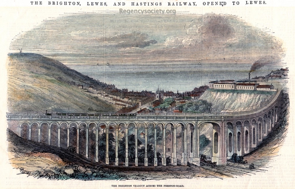
BPC00442
There is a close-up view of this image: click here to see the detail
Wood engraving from the Illustrated London News, 13 June 1846.
With this viaduct the Brighton, Lewes and Hastings Railway was opened to Lewes. Brighton Railway Works are on the right-hand cliff top.
There are 7 recorded views of the Preston Road Viaduct and this image has the earliest date, published just three months after completion.
In the 1840s the land north-east of Brighton station was undeveloped, consisting of fields. It lay in a steep-sided valley running from north to south, created by the now mostly underground River Wellesbourne. The railway architect J U Rastrick had to decide whether to cross this natural valley with an embankment or a viaduct. Local opinion favoured an embankment, and he faced opposition and criticism when he chose to build a viaduct. Nevertheless, he planned the route and laid the foundation stone on 29 May 1845. Construction took 10 months: the structure was ready on 28 March 1846, more than two months before the line to Lewes opened. By the 1870s dense terraced housing surrounded the viaduct, residential development that was stimulated by the opening of the railway.
The structure is 1,200 feet (370 m) long, and reaches a maximum height of 67 feet (20 m) above the floor of the valley. It consists of 26 semicircular arches each of 30 feet (9.1 m) with piers of 7 feet (2.1 m) thick at the base and 5 feet (1.5 m) thick at the top, together with one elliptical arch of 50 feet (15 m) over a section of the A23 London Road called Preston Road. The piers of this arch are 22 feet (6.7 m) thick at the base and 19.5 feet (5.9 m) thick at the top.
See all images of outer Brighton and Hove
loading map - please wait...