Category: Maps
A New Plan of Brighton and Kemp-Town. Divided into Wards Pursuant to the Reform Bill
BPC00004 East There is a close-up view of this image. Click here to see the detail Published in Wallis’s Royal Edition of Brighton As It Is, 1836, Exhibiting All The Latest Improvements in that Fas... Read More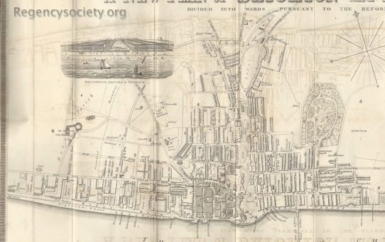
A New Plan of Brighton and Kemp-Town. Divided into Wards Pursuant to the Reform Bill
BPC00004 West There is a close-up view of this image. Click here to see the detail Published in Wallis’s Royal Edition of Brighton As It Is, 1836, Exhibiting All The Latest Improvements in that Fa... Read More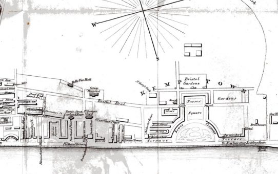
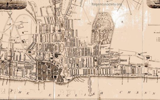
Plan of Brighton and Its Environs including all the Recent Improvements (detail)
BPC00200 Published in W Saunders’s Stranger’s Guide to Brighton, being A Complete Companion to that Fashionable Watering Place and The Rides and Drives in its Vicinity. Published 1850. By this dat... Read More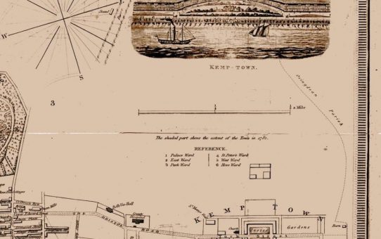
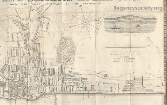
A New Plan of Brighton and Kemp-Town. Divided into Wards Pursuant to the Reform Bill
BPC00199 Published in Wallis’s Royal Edition of Brighton As It Is, 1842, Describing Every Recent Improvement. This map shows virtually no change from the previous 1836 edition. Both show the buildin... Read More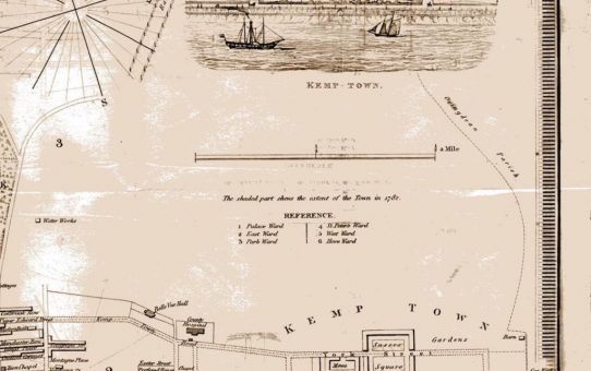
A New Plan of Brighton and Kemp-Town. Divided into Wards Pursuant to the Reform Bill (detail)
BPC00198 Published in Wallis’s Royal Edition of Brighton As It Is, 1836, Exhibiting All The Latest Improvements in that Fashionable Watering Place. See all images of the Kemptown Estate in the Kempt... Read More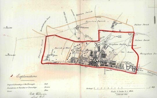
Brighthelmstone. From the Ordnance Survey 1831
BPC00130 Map drawn by Lieut Robert K Dawson of the Royal Artillery, dated 1831. In the centre of this map is the identification ‘Church Hill’. Just above the word ‘Church’ is depicted a windmi... Read More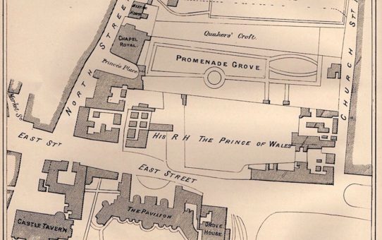
A series of wood engravings from J G Bishop’s ‘A Peep into the Past’: 2
BPC00039 Plan of the Promenade Grove in 1803 A series of wood engravings from J G Bishop’s A Peep into the Past: Brighton in the Olden Time. 1880 and republished 1892: See others in this series: Ol... Read More