
Hover over image to view
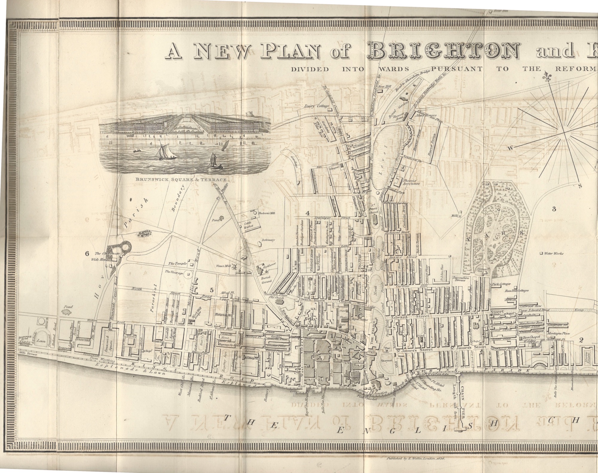
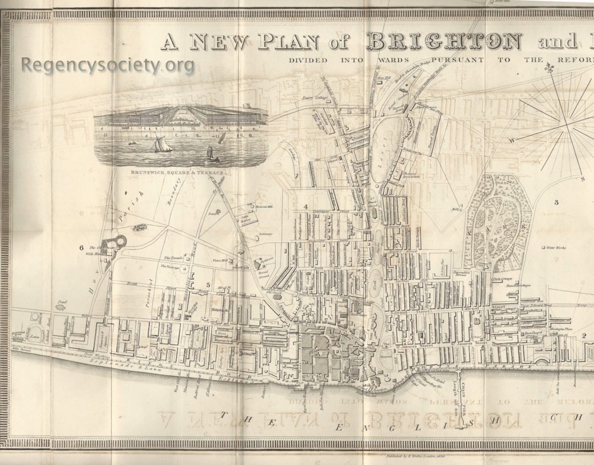
Published in Wallis’s Royal Edition of Brighton As It Is, 1836, Exhibiting All The Latest Improvements in that Fashionable Watering Place.
Identifying Vine’s Mill, which is named towards the left of the map, just above the mill is the Church Hill School (number 5 on BPC00003). It can be seen that the school had a generous amount of land around it, and the western edge of this land is now taken by numbers 20 to 22 Clifton Hill, built within about fifteen years of this map.
View the main entry for this image