
BPC00002
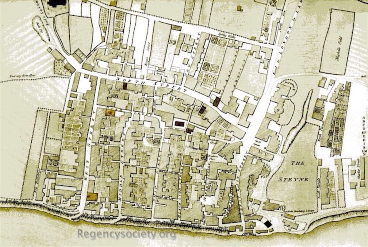
by Thomas Budgen 1788.
At this date the route we know as Church Street is called Spring Walk, and Mighell’s Field (to the right of the map) is where Grand Parade will later stand. Today there is a very short ‘Mighell Street’ just off Carlton Hill. The Marine Pavilion is now taking shape, and the bay windows of the original farmhouse have been duplicated on the northern side of the new central rotunda. The entrance to the Pavilion is on its western side, as it is today, but is still on the main public road into town from London, which, at this date, still runs past the Pavilion’s west side and on into the western side of Castle Square, finishing in Great East Street.
All maps: (click on image to see the full entry)
View all galleries on the galleries page
Hover over the image to see the image number followed by the date when the image was produced.
Click on any image to see its full entry.


